Thursday 31 March 2016

Blackwood Walk - Lerderderg Gorge National Park


Blackwood Walk

Lerderderg Gorge National Park

O'Briens Crossing to Blackwood Circuit


Thank you to Glenn Tempest and his book Jaywalks Around Victoria.

Friday, 25 March.

It has been a long time between walks.


Selling a house. Moving interstate. New careers.

I can tell myself the break was for the benefit of Shell's injury prone ankle. In reality it has come down to the reluctant realisation that I do not handle hiking in hot weather.

Autumn in Victoria. Perfect weather to get back on the trail.


A lazy twenty kilometer circuit would be a fun hit out.

This trail starts at O'Briens Crossing.

We arrived mid morning. As it was a long weekend the place was full of campers. The 4WD variety that packs chainsaws, webbers, eskies and music systems to escape the rat race of city or suburban living.


The hike starts with a short uphill climbs stroll. One of only two making this an easy hike.

Head past the camp toilets. After a few hundred meters keep an eye out for the trail dropping down to the right. If you continue upward to the left you end up back on O'Brien Road.


It is a pretty trail which follows a water race for the most part.


The temperature was cool and the mood was upbeat.

I had forgotten how much fun it was to hike with Shell.

Stay on Byers Back Track. Ignore the intersections, Ambler Lane, Gribble Track, Kangaroo Track and Deadmans Track.


Long the way you will come across some old gold mine tailings which remain somewhat intact.


Just before you reach Golden Point Car Park and a short stroll to the town of Blackwood is an abandon mine. Certainly worth a look.


If you are brave enough (Shell), work your way all the way into the crawl space. If not (me), at least make it to the first turn before scurrying back to the daylight like the coward you are....


Turn right onto Golden Point Road and follow it all the way up to Blackwood for lunch.

It is a rare luxury to have a Pub at the half way point of a circuit hike.


After a lazy lunch we headed back down Golden Point Road and took a right onto North Blackwood Road.

Follow this dirt road all the way to the top. Continue right and you will come across Tunnel Point Track on your right hand side.


It is a quick trip back to O'Briens Crossing and mostly downhill.


At the end of the track is an old tunnel built by miners. Not much to see really.


Head up Gribble Track for a steep few hundred meters before turning left back onto Byers Back Track.


It is simply a matter of retracing your steps for a few kilometres and you are back to the car.


This was a great first hike back. Relatively flat and easy despite Shell's demanding pace.

So good to be back in the saddle.

Maybe we could do something similar in a few days?


Monday 20 April 2015

Western Plains Traverse - Victorian Alps National Park

Western Plains Traverse

Victorian Alps National Park

Bogong Village Victoria


Thank you to Glenn van der Kniff and his book Bushwalks in the Victorian Alps.

Saturday, 11 April.

We had planned to do the Green Valley Trail over this week.

A few weeks prior to the trip Shell suggested another trip to the Alps before winter might be the better option so we switched Green Valley to winter.

Instead we would do the Western Plains Traverse.

Car shuffling is almost impossible. 

We planned to hike in to Bogong Jacks, camp the night and do a return trip to Pretty Valley Pondage via Tawonga huts. Return to Bogong Jacks and hike back to the car next morning.

With prior commitments on Saturday we packed the evening before and headed to Yass for the evening.

We spent the night on the cattle property Fifeshire, about 30km outside of Yass.

Sunday, 12 April.

An early rise had us on the road from Fifeshire to Yackandandah before 7.00am.


A beautiful sunrise over Fifeshire.


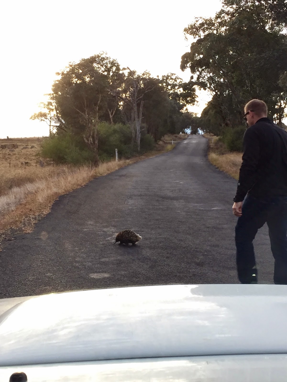
Country roads are no place for slow moving pedestrians.

After catching up with family for a cup of tea in Yackandandah we detoured to Myrtleford for an early lunch at a cafe we discovered on our last Alps trip.

Access to the trail head from Myrtleford is via Mt Beauty.

Heading South on the Great Alpine Road toward Ovens and take the left onto Happy Valley Road.

Follow Happy Valley Road to its end, turning right onto Kiewa Valley Road.

Continue through Mt Beauty and on to Bogong Village on the Bogong High Plains Road.

Glenn van der Kniff states 'vehicles can be left on a grassy clearing opposite a fire track, about 300m south of the turnoff into Bogong itself'.

This is correct however the fire track is now tarred gated. It is the entrance to the Bogong water tunnel which supplies the drinking water to the village.

A clear sign on the gates states 'vehicle access prohibited'. 

Taking this literally we slipped past the fence and headed up the fire trail.


Vehicle access prohibited.

We arrived at he trail head around 2.00pm.

I had been following the weather for the previous few weeks. I tend to struggle in the heat and I was looking forward to hiking in the cooler climate of the Alps.

My research suggested temperatures between 0 and 12C. Considering we had a 1000m ascent to Bogong Jacks campground I was willing to concede it to be a little warmer at the trail head.

It was 26C.


Ready to go.

The walk to Bogong Jacks campground is on a fire trail. The trail leads up. And up some more.

No more than a few kilometres into the journey I began to complain. 

Tired and irritable from the drive and feeling childishly cheated by the heat I became unpleasant company.

Shell soon grew tired of my complaints.

A lengthy rebuke which I will not detail ensued. Suffice to say I was quickly brought to silence.

The trail up is simple with three path options.

All are easily navigated. Put simply you always head up.

Once on the Fainter Track, stay on it.


The first intersection.

For some time the hike is not inspiring. In my experience this is often the case with service trails.

Once the noxious blackberries disappear in some elevation is achieved you are occasionally given a view of the landscape beyond.


Noxious blackberry common lower on the trail.


Views during the climb.

It becomes apparent the service track is seldom used.

The climate is cooler at this altitude. My mood lightened despite the deserved savaging to my ego Shell delivered a few hours earlier.

After 9km and around 1000m in ascent the trail levels.

Soon after you reach Bogong Jacks campground.

Glenn van der Kniff writes there is water available from a spring before the campground. This spring was no more than a muddy patch when we arrived.

I would not rely on Bogong Jacks for water.

The campground is a large clearing. Fenced and gated I can only assume it was a mustering point for cattle when they were once grazed in the area.

After discovering Bogong Jacks hut off to the east we pitched the tent.

We rarely light camp fires. On this occasion we did.

The temperature was dropping quickly and the sun was setting. It seemed appropriate.

As the sun went down I realised I had broken my clear glasses.


The rather unimpressive Bogong Jacks hut.


Sunset in the Alps.

The temperature dropped below zero that night.

The Alps are my favourite place in Australia.

I lay there, naked and the sleeping bag open like a blanket to stay cool.

Next to me Shell had three layers on and was wrapped like a caterpillar trying to stay warm.

Looking out the vestibule I could see an infinity of galaxies and hear not a sound beside Shell's slow breathing.

It was perfect.

Sunday, 12 April.

I was up before dawn.

I hate to miss a sunrise.

A few merino layers and a soft fleece and I was not cold.

Ice covered everything.

The entire clearing was white. Covered in a thin layer of ice.

It was beautiful.

While Shell slept I watched the morning melt the ice.


Predawn.


Sunrise.


Yet to see a bad sunrise in the Alps.

We made some breakfast and packed the day packs ready to walk to Tawonga Hut and onto Pretty Valley Pondage.

The plan was to travel light. Lunch was to be at the pondage and we would return to Bogong Jacks and hike out the next morning.


Breakfast.

The trail leads out to the South heading up on a disused service trail.

As you reach the highlands the service trail soon becomes an actual walking trail.


The trail from Bogong Jacks.

We stopped briefly at Mt Faintier South for some food.

Sitting there with Mt Feathertop in the near distance, blue skies and cool air, we lingered in conversation.

Much was said. All of it personal. All of it good.


A place for conversation.

We left with a spring in our step.

We continued in light conversation.

I estimate we were 1-2km from Tawonga Hut when Shell went over on her ankle.

The same ankle she injured a few weeks before heading to Blue Gums in The Blue Mountains.

We both heard the 'pop'. She went down so fast. Clearly in pain.

I feared it was broken.

We sat for a moment where she fell. It was obviously worse than before but I no longer feared a break. A fracture was not yet out of the question.

I removed her boot. It was swelling and colouring fast.

I quickly bandaged it and put her boot back on.

I emptied her pack into mine and shouldered her pack on my front.

After a time, with the help of walking poles Shell attempted to weight bear.

She managed, but was clearly in discomfort.

I did the numbers in my head. It was 12.00pm. It was 10km back to camp and a further 10km to the car.

20km on a bad ankle.

I put it to Shell and there were no arguments. It had to be done. 

Should we make it back to the camp and stay the night she would not be able to walk on it at all the next day.

I contemplated a helicopter.

Shell produced some Ibuprofen and Mydol from her infinite supply and off we set.

The going was slow.

Time concerned me. Not time. Daylight.

Sunset was around 5.30pm. We would have light until 6.30pm I guessed.

At our current pace we would not make it.

Service trail on a bad ankle by torchlight? Sounded interesting.

Shell suggested I head back to the campground and pack the tent and everything I could in my pack.

I was loathe to leave her but it made sense. Especially with my rising concern over time.

I headed off.

I worried about Shell the entire time. I hated leaving the woman I loved behind and injured.

Soon after I was done I headed back up the trail to meet Shell. She was not far from camp and making better pace. Ibuprofen and Mydol are not to be under estimated.

It was 2.30pm.

There is not much to say of the trip down. Though it was not without incident.

It was entirely stressful.

Shell pushed on in clear pain. Her mental and physical toughness is incredible.

When it became apparent we might make the car before darkness I took us down the wrong path.

Not even remarks about the unfamiliarity of the path made me question the decision.

It was a large clearing which was entirely foreign that brought us to a stop. A map check showed my error.

I was furious with myself. I had just added four kilometres to the trip.

Furthermore it would be certainly dark when we arrived at the car.

Soon after we arrived back on the correct path we ran out of water.

We limped on.

The sun went down and the head torches came out.

Suddenly there were side trails everywhere and decision making crucial. Made all the more difficult without my glasses.

It was a hectic last few kilometres.

By the time we reached the car we had covered over 30km in a day.

It was a stressful hike. Tough going with an injured companion.

We made quick accommodation arrangements as we were driving through Mt Beauty.

We both suddenly became aware of how hungry we were. Having not eaten since breakfast it was close to 9.00pm.

We stumbled across a takeaway in Myrtleford which delivers the best hamburger I have ever eaten. EVER!

After a hot shower at the Motel we both fell asleep relieved and exhausted.

Monday, 13 April.

I laid awake for some time this morning.

Shell slept next to me. Safe.

I went through the previous day and evening in my mind.

We were truly in danger? What could I have done different?

At the time I was single minded in my effort to get us sadly back to the car. Beside the immediate threat of another rolled ankle I did not consider long term possibilities.

I rolled over and put an arm around Shell. Safe.

I fell back asleep which is a rare thing.


The last thought I can recall is where we might hike in the Alps in Spring.

Tuesday 24 March 2015

Victoria Falls to Blue Gum Forest - Blue Mountains National Park


Victoria Falls to Blue Gum Forest (Return)

Blue Mountains National Park

Mt Victoria NSW


Saturday, 21 March.

A tale of poor planning, an underestimated trail and injury.

Shell is an adventurer, a risk taker. A free spirit who throws caution to the wind.

Quickly bored with the logistics of planning. Unwilling to become tied down with tedious details.

Most often Shell will find a destination and leave the 'getting there' to me.

I am not complaining. My role as planner suits my personality. A list maker. A purchaser of maps.

Information and research is what I enjoy.

We share a balance.

Shell pushes me from my comfort zone and I attempt to keep our walks non life threatening.

This symbiotic relationship works well. Most of the time.

On this occasion my preparation was poor. Limited on time I read a few quick reviews on the hike and made some incorrect assumptions on distances.

The plan was to hike into Blue Gums and return on that evening. I estimated the return trip to be just over 20km.

In hindsight we fell well short of our goal though we still managed 19km in 9 hours.

This trail was difficult in the wet conditions. When Shell rolled her ankle my miscalculations became even more problematic.

Because we always pack for overnight hiking there was no real danger.


Heading South on the M1 simply follow the signs to the Blue Mountains.

Passing through Blackheath and take Mt Victoria Road on the right.

This dirt road terminates at the trail head after about 5km.

We arrived at 9.00am after coffee and breakfast in Springwood.

It was raining and thick with fog.

Regardless, we were both keen for another solid hit out on the trail.


Trail head.


A wet and foggy start.


Ready to go in wet weather gear.

Though I had commented on the weather during the trip I was looking forward to a wet wether hike.

The temperature was still mild and modern gear manages to keep you dry for longer.

The mood was light hearted as we set off.

The trail quickly arrives at the Grose Valley lookout.


Sweeping views of the Grose Valley.

The trip down to the falls and the valley below can be steep at times.

The trail is clearly marked and easy to follow.

Considering the weather, we took our time as the wet rocks were occasionally slippery and at times the drop is sheer and long.

Caution aside, the trail descends quickly and the scenery is pleasant.


The hike to the valley floor.


Close to the bottom there is an opportunity to detour to the Cascades.

The walk is short. Through a pretty rain forest to the Cascades.

The Cascades are certainly worth the walk.


Through to the Cascades.


The Cascades.

Soon after is another side trip to the top of the Victoria Falls.

Another short journey which is worth the effort.

I have mentioned previously how much I love these streams.

The sound of fast moving crystal clear water over a rock bed is hypnotic. Its subtle music followed us for the entire hike.

I recall falling asleep to this tune in the Victorian Alps.


The top of the Victoria Falls.

Another short hike, one which requires the most caution in wet conditions, brings you to the base of the falls.

Victoria Falls is two separate drops. While not as inspiring as a single drop the sandstone backdrop makes for a pleasing view from the base.


The base of the falls.

Continuing on Shell set a good pace considering the terrain.

Despite the rain and blissfuly unaware I had under estimated the distance of the hike by over 6km our spirits were as we made our way through the Grose Valley.


The trail on the Grose Valley Fall.

Occasionally the trail was washed out.

Easy to cross we applied some caution as the footing was wet and slippery.


The trail washed away in several places.

The trail follows the Grose River.

I could not help but feel I was an extra in Jurrasic Park. My imagination wandered.

At any moment I expected T-Rex to materialise and eat Shell.

Thank goodness I had my pocket knife and would have little trouble coming to her aid.

The trail crosses the Grose River three times in total.


The three crossings of the Grose River.

We were making poor time in the conditions.

It would be fair to say that the trail had started to grind on me somewhat.

For some reason I wanted to stretch out and find a fast rhythm.

After the third crossing the trail became littered with fallen banksia flowers.

Shell wondered aloud which tree they had fallen from.

Marching on and her eyes in the trees she stepped on an innocuous stick.

For some strange reason I was watching her feet when it happened. Her ankle rolled and down she went.

Shell is a tough girl. I have seen her run, train and compete with injuries that would sideline most.

This was a bad.

On a positive note I did get to use the medical kit.

We strapped her ankle and she attempted to put weight on it.

It was clear she was in pain and I attempted to turn us around.

A lively debate ensued.

It ended this way.

"This is not some kind of fucking toughness competition!" I shouted in frustration.

"If it was I would win the trophy and you would be last!"

With that she turned and limped down the trail.

I followed.


Flora on the hike.

The hike became a chore.

I spent the entire time watching where Shell put her feet.

At any moment I worried she would slip and require weight be put on her injury.

I worried about the climb out. The slippery footing and the sheer edge we needed to follow.

My suggestions of possible foot placement were interpreted as criticism.

Pleads to turn around were seen as negativity.

The mood was darkening.

It is hard to watch the person you love trudge on injured.

I did not know whether to admire her tough determination or marvel at her stubbornness.

Her limp was slowing us down but I dare not mention the fact.

In my mind I had ruled out camping the night.

In my experience sprains like these swell when the boot is removed and are worse the next day.

We reached the intersection of Pierces Pass and Acacia Flats and it dawned on me just how far I had misjudged this hike.

The sign indicated Acacia Flats follow the ridge line but the trail seemed to have completely washed away.

After twenty minutes scrambling the hillside trying to find the trail, the day getting late and the realisation just how far we had ahead of us I decided we needed to turn around.

We had it out at the intersection.

It was clear she viewed not making Blue Gums as a failure.

She even mentioned this blog and how I would feel not making it to Blue Gums.

Playing to my ego is usually a solid ploy but her welfare came first.

A lot was said during this 'debate'. Much of which Shell has taken back.

Needless to say we turned around.

A rare victory if one was counting.


Red triangle slug.

The hike back was tough.

Shells ankle was getting worse but she would never admit it.

I kept my words to encouragement. Always a safe bet.

The weather remained constant making the climb out slippery.

It was a stressful ascent.

When we finally made it to the Grose Valley lookout at the top we were both exhausted.

The weather had cleared and the view was stunning.


Grose Valley Lookout.


Tired and relieved.


We had travelled 19km in nine hours that day.

For Shell 14km of this hike was on an injured ankle.

It was a challenging day.

There is no doubt this is a beautiful place to visit.

I had underestimated the terrain and the distance this day.

I will take a lot away from this hike. I have learnt a lot.


Shell's ankle on Sunday morning.

It is Tuesday morning as I am writing this.

We ran this morning.

I didn't even try to convince her it was a bad idea.